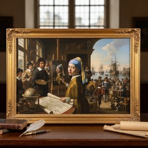
The Architect of the Earth: The Life and Legacy of Willem Blaeu
In the golden age of Dutch exploration, when the horizons of the known world were expanding through the daring voyages of the East India Company, one man possessed the singular vision to capture that vastness on paper. Willem Janszoon Blaeu, born in 1571 near Alkmaar, was far more than a mere printer; he was a master of spatial storytelling. His journey did not begin with the ink of a cartographer, but with the celestial observations of an astronomer. Driven by a profound curiosity about the heavens, Blaeu traveled to the island of Hven to study under the legendary Tycho Brahe. This apprenticeship in the rigorous mathematics of astronomy provided him with a scientific foundation that would later distinguish his maps from the mere illustrations of his contemporaries. He learned not just how to see the stars, but how to translate the infinite geometry of the cosmos into the tangible precision of globes and instruments.
Upon returning to the bustling maritime hub of Amsterdam, Blaeu transformed his scientific expertise into a commercial and artistic empire. By 1605, he had established a printing business that would become a cornerstone of the Dutch Golden Age. His work was characterized by an exquisite marriage of technical accuracy and aesthetic splendor. To hold a Blaeu map was to hold a window into a world being rediscovered; his lines were precise, yet they were adorned with the vibrant artistry of the era, featuring intricate cartouches, sea monsters, and delicate flourishes that breathed life into the silent expansions of the ocean. His appointment as the official hydrographer for the Dutch East India Company (VOC) in 1633 marked the pinnacle of his professional prestige, granting him access to the most secretive and cutting-edge geographical data of the age.
A Legacy Written in Ink and Gold
The true magnitude of Blaeu’s contribution lies in his ability to synthesize information into monumental works of reference. His publications were not merely tools for navigation but were profound cultural artifacts that shaped the European understanding of geography. The Atlas Maior, though reaching its most magnificent form through the continued efforts of his family, stands as a testament to the tradition he ignited. These atlases were masterpieces of multi-lingual scholarship, published in Latin, French, German, and Dutch, ensuring that his vision of the world reached the desks of scholars, merchants, and monarchs alike.
The impact of his career can be seen through several defining achievements:
- Scientific Precision: The integration of astronomical observations from his time with Tycho Brahe into maritime cartography.
- The Atlas Tradition: Establishing a lineage of atlas-making that prioritized both the density of information and the beauty of presentation.
- Global Influence: Creating a standardized visual language for geography that supported the era's great maritime expansions.
- Artistic Innovation: Elevating the map from a functional tool to a high art form through detailed engraving and hand-colored embellishments.
As we look back upon the works of Guilielmus Blaeu, we see more than just historical documents; we see the heartbeat of an era defined by discovery. His life was a bridge between the medieval reliance on myth and the modern era of empirical measurement. Through his globes, charts, and atlases, he did not just record the world—he helped define it for generations to come, leaving behind a cartographic heritage that remains as breathtaking today as it was in the seventeenth century.
Otázky a odpovede
Môžem si prehliadnuť diela umelca Guilielmus Blaeu podľa umeleckého smeru?
Diela umelca Guilielmus Blaeu si môžete prehliadnuť podľa umeleckých smerov na stránke Všetky smery daného umelca.
Kde si môžem pozrieť všetky diela umelca Guilielmus Blaeu?
Každé dielo umelca Guilielmus Blaeu na táto webstránka si môžete prehliadnuť na jeho stránke Všetky diela.
Aká je popularita diel umelca Guilielmus Blaeu?
Stránka Štatistiky umelca Guilielmus Blaeu zobrazuje štatistiky vypočítané z diel umelca uvedených na táto webstránka.