


 实景预览
实景预览
 分享
分享 分享
分享
 详情
详情 指南
指南

 下载作品
下载作品
 相似作品
相似作品 X射线
X射线 幻灯片播放
幻灯片播放 Q&A
Q&A 统计数据
统计数据Corsica

 展开全文
展开全文
艺术微喷/版画
博物馆级艺术微喷或帆布版画,制作高效,并提供多种饰面选择。 ( 订购纯手工绘制画作 切换至数字图像销售渠道)
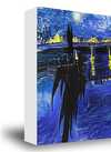
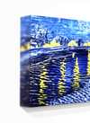
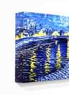
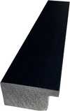
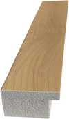
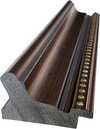
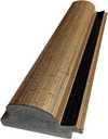
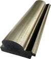
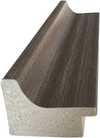
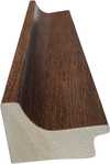
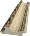
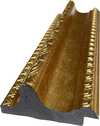
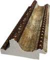
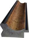
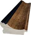
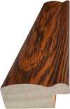
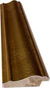

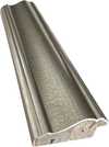
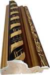
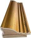
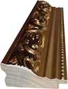
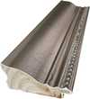
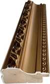
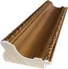
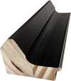
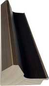
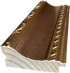
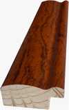
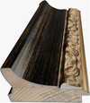
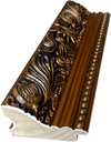
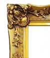
您可以从与原作比例一致的预设尺寸中进行选择。

请输入您所需的宽度和高度,以适配您的画框或墙面。由于印刷品只能进行裁剪,无法超出原图尺寸,因此若比例不一致,画面的一部分将会被裁切。在正式印刷之前,我们会为您发送一份数字效果图供您确认。本页面显示的图片并非最终裁剪后的效果——只有效果图才能展示真实的裁剪情况。


 玻璃选项仅适用于110厘米以下的尺寸。

Corsica
艺术微喷/版画
复刻品尺寸
-


最终结算价
¥ 430
相似作品


艺术家简介
A Cartographer of Empire: The World According to Thomas Jeffreys
Thomas Jeffreys, a name perhaps less celebrated than his contemporaries yet pivotal in shaping the visual understanding of the 18th-century world, was born in London in 1719. He entered an era brimming with exploration, colonial ambition, and a burgeoning demand for accurate geographical representation. While details of his early life remain somewhat elusive, it is known that he established himself as a mapmaker and engraver, quickly gaining recognition for the quality and artistry of his work. Jeffreys wasn’t merely copying existing charts; he synthesized information from diverse sources – travelers' accounts, official surveys, and previous cartographic endeavors – to create maps that were both informative and aesthetically compelling. He operated in an age where mapmaking was a complex blend of scientific endeavor, artistic skill, and political projection, and Jeffreys navigated this landscape with considerable acumen. His career flourished during the reigns of George I and George II, periods marked by significant British expansion and increasing global trade.The Art of Depiction: Style and Influences
Jeffreys’ maps are immediately recognizable for their distinctive style. He favored a richly ornamented aesthetic, incorporating elaborate cartouches, detailed depictions of flora and fauna, and often, allegorical figures representing the regions portrayed. This wasn't simply decorative flourish; it reflected the prevailing taste for visual grandeur and served to emphasize the wealth and power associated with the territories depicted. His work stands apart from the more austere, mathematically focused maps produced by some of his contemporaries. He blended scientific accuracy with artistic license, creating images that were both useful navigational tools and compelling works of art. Influences on Jeffreys’ style can be traced to earlier cartographic traditions, particularly those of Dutch mapmakers like Johannes Blaeu and Frederick de Wit, renowned for their detailed and decorative maps of the East Indies and Americas. However, Jeffreys infused his work with a distinctly British sensibility, emphasizing the role of British exploration and commerce in shaping the global landscape. He also drew inspiration from contemporary architectural designs and ornamental patterns, evident in the intricate borders and cartouches that frame his maps.Charting New Worlds: Major Works and Achievements
Jeffreys’ most significant achievement lies in his ambitious project to create a comprehensive atlas of the world. The Complete Illustration of Universal Geography, published in installments between 1744 and 1761, became one of the most influential atlases of its time. It wasn't simply a compilation of existing maps; Jeffreys meticulously revised and updated each chart, incorporating new discoveries and correcting inaccuracies. The atlas was particularly notable for its detailed depictions of North America, reflecting the growing British presence in the region. His map of Virginia, for example, provided valuable information about the colony’s geography, resources, and Native American settlements. Beyond his atlas, Jeffreys produced a series of highly sought-after individual maps focusing on specific regions, including Europe, Asia, Africa, and the West Indies. He also published several volumes of illustrated geographies, aimed at educating a wider audience about the world beyond their shores. His work wasn’t limited to large-scale atlases; he created smaller, more portable maps for travelers and merchants, demonstrating his versatility as a cartographer.A Legacy in Lines: Historical Significance
Thomas Jeffreys' contribution extends far beyond the aesthetic beauty of his maps. He played a crucial role in shaping public perception of distant lands during an era of intense colonial competition. His detailed depictions of North America, for instance, helped to fuel British expansion and solidify its claims to territory. His maps weren’t neutral representations of geography; they were imbued with political and economic agendas, subtly promoting the benefits of British trade and colonization. The accuracy and detail of his work made them invaluable resources for explorers, merchants, and policymakers alike. Even today, Jeffreys' maps remain highly prized by collectors and historians as important primary sources for understanding the 18th-century world. They offer a fascinating glimpse into the geographical knowledge – and biases – of the period, revealing how Europeans perceived and represented distant cultures and landscapes. His legacy lies not only in his artistic skill but also in his ability to translate complex information into visually compelling narratives that shaped the course of history. Jeffreys’ maps continue to resonate as testaments to a time when cartography was both an art form and a powerful tool of empire.
Thomas Jefferys
1719 - 1771
艺术家简介
- Full Name: Thomas Jefferys
- Nationality: British
- Date Of Birth: 1719
- Date Of Death: 1771
- Place Of Birth: London, England
- Notable Artworks:
- The Russian Discoveries
- A Plan of all the Houses, destroyed & damaged by the Great Fire
- Artistic Movement Or Style: Early Enlightenment
- Artists Who Influenced This Artist:
- Charles Price
- John Seller
- Artists Or Movements Influenced By This Artist: ['Andrew Dury']
相关文章

Thomas Sandby: Pioneering Watercolourist & Topographer of Georgian England
Explore the life & art of Thomas Sandby (1721-1798), a pioneering English watercolourist and architect. Discover his innovations, role in founding the Royal Academy, and lasting legacy at AllPaintingsStore.
Thomas Hudson: A Study in 18th-Century Portraiture & British Artistic Identity
Explore the life & work of Thomas Hudson, a leading 18th-century British portraitist. Discover his mastery of the 'Grand Manner,' influential style, and lasting impact on British art. Learn about his notable portraits like Judge William Noel & Alexander Van Aken.

Mapping Beauty: Transform Your Space with Stunning Topographical Artworks
Elevate your interiors with breathtaking topographical art. From vintage cartography to textured 3D reliefs, discover how hand-painted maps and historical landscapes can transform any room into a sophisticated sanctuary of discovery and timeless beauty.

Thomas Barker of Bath: Landscape Painting & Societal Reflection in Early 19th-Century England
Explore the life & work of Thomas Barker of Bath, a key figure in 19th-century English Romanticism. Discover his Parisian success, iconic paintings like 'The Bride of Death', and lasting artistic legacy. Learn more at AllPaintingsStore.

18th Century Masters: 10 Artworks That Define an Era | AllPaintingsStore
Journey through 18th century art! Explore 10 iconic paintings – from Rococo elegance to Neoclassical grandeur. Discover Fragonard, David & more. Find museum-quality reproductions and elevate your home decor on AllPaintingsStore.com.

