


 プレビュー
プレビュー
 シェアする
シェアする シェアする
シェアする
 詳細を見る
詳細を見る ガイド
ガイド

 ダウンロード
 似ている作品
 X線調査
X線調査 スライドショー
 統計情報
統計情報The Clover Leaf Map, 1585
 Woodcut
 1585
1585- Early Modern
 30.0 x 39.0 cm
 イスラエル国立図書館
 詳細を見る
詳細を見る
手描き油彩複製画
当社のアーティストが、お客様のご希望のサイズと額縁に合わせて、キャンバスに手描きで制作する油彩画です。 ( プリント版に切り替え デジタル画像販売へ切り替え)
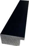
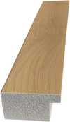
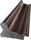
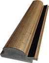
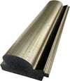
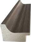
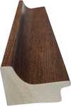
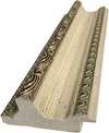
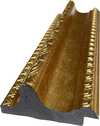
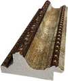
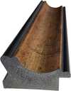
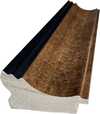
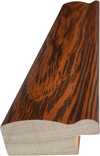
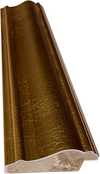
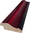
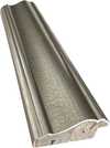
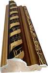
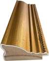
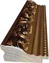
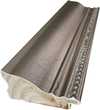
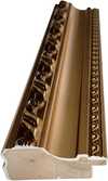
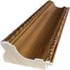
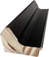
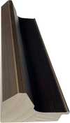
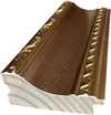
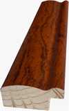
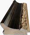
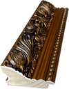
作品のオリジナル比率に合わせた、当店の規定サイズからお選びください。

特定のフレームやスペースに合わせて、ご希望のサイズをご入力いただけます。選択されたサイズが元の画像の比率と異なる場合、アートワークをトリミングするか、手描きで要素を追加して絵画を拡張いたします。デジタルモックアップ を制作し、制作開始前にご確認(承認)をいただきます。
画面上のプレビューは、実際のトリミングや拡張を正確に反映しているものではありません。最終的な構図は、モックアップによってのみ正確にご確認いただけます。
カスタムサイズもご利用いただけますが、元の比率を維持するためには、あらかじめ用意されたリストからサイズを選択することをお勧めいたします。
ご注文後、AllPaintingsStore.com チームより詳細な指示をお送りするとともに、仕上がりイメージ(モックアップ)をご提供いたします。


 ガラスオプションは、110cm未満のサイズでのみご利用いただけます。

The Clover Leaf Map, 1585
複製技法
複製画のサイズ
-


合計金額
$ 258
A Cartographic Vision of the Renaissance World
In the late sixteenth century, the boundaries of the known world were expanding with every voyage and discovery, yet the way humanity perceived its place within the cosmos remained deeply intertwined with spiritual conviction. The Clover Leaf Map, 1585, stands as a breathtaking testament to this era of profound transition. Created by the innovative minds of Heinrich Bunting and Jacobus Lucius, this exquisite piece is far more than a mere navigational tool; it is a symbolic tapestry that weaves together geography, theology, and the burgeoning spirit of humanism. The map’s unique four-lobed structure, reminiscent of a clover leaf, offers a rhythmic and harmonious division of the globe, presenting Europe, Asia, Africa, and America not as disconnected landmasses, but as interconnected petals of a single, divine creation.
The visual language of the piece is both vibrant and deeply communicative. Through a deliberate and striking color palette, the artists guide the viewer’s eye across the hemispheres: the warm reds of Europe, the sun-drenched yellows of Asia, the lush greens of Africa, and the cool, mysterious blues of the Americas. This chromatic distinction does more than separate continents; it evokes the diverse climates and spirits of these distant lands. Scattered throughout this intricate web of borders and coastlines are delicate depictions of various peoples, capturing the essence of different cultures and civilizations as they were imagined in the German imagination of 1585. Each tiny figure and regional detail serves to populate the void, transforming a flat surface into a living, breathing portrait of a world teeming with life and mystery.
The Intersection of Faith and Discovery
To understand the soul of this work, one must look toward the biography of its creator, Heinrich Bunting. As a theologian and cartographer, Bunting possessed a rare ability to merge the rigorous study of Holy Scripture with the emerging science of mapmaking. His masterpiece, the Itinerarium Sacrae Scripturae, sought to map the very journey of faith through geography. In this clover leaf composition, we see the fingerprints of that scholarly devotion. The precision of the woodcut technique allows for a level of detail that invites prolonged contemplation, where every small country and coastal inlet tells a story of discovery and divine order. For the collector or the lover of history, this piece represents a moment in time when science and spirituality were not yet at odds, but were instead two lenses used to view the same magnificent reality.
For those looking to bring a sense of intellectual depth and historical grandeur into a curated space, this reproduction offers an unparalleled opportunity. Whether placed in a sophisticated study, a library, or as a focal point in a contemporary living area, The Clover Leaf Map acts as a conversation piece that transcends mere decoration. It evokes a sense of wanderlust and a deep respect for the heritage of human exploration. The artwork’s ability to blend academic rigor with aesthetic beauty makes it an ideal selection for interior designers seeking to infuse a room with character, warmth, and a timeless connection to the great age of discovery.
関連作品


アーティストの略歴
Heinrich Bunting & Jacobus Lucius: Cartographer of Faith
Heinrich Bunting, a name perhaps less familiar than those of his contemporaries in the vibrant world of 16th-century German art and theology, nevertheless stands as a profoundly unique figure. Born in Hanover in 1545, he wasn’t merely a pastor or theologian; he was an innovator who fused the rigor of scholarly biblical study with the burgeoning art of mapmaking, creating the remarkable “Itinerarium Sacrae Scripturae” – a travel book through Holy Scripture rendered in exquisite woodcuts. This ambitious project, first published in 1581, represents a fascinating intersection of faith, geography, and early printing technology, offering a glimpse into how religious thought shaped the visual representation of the world during a period of immense intellectual and artistic transformation.
Bunting’s early life suggests a man deeply rooted in both academic pursuits and practical concerns. He studied theology at the prestigious University of Wittenberg, graduating in 1569 – an institution then at the heart of the Protestant Reformation. This education provided him with a solid foundation in biblical scholarship, which would later inform his meticulous approach to mapping the locations referenced within scripture. Following his studies, he served as a pastor in Lemgo, but a subsequent dismissal and relocation to Gronau marked a period of upheaval and ultimately led him to Goslar, where he was eventually removed from his position due to theological disagreements. This series of professional setbacks culminated in his retirement to Hanover, where he spent the remainder of his life quietly.
The Itinerarium Sacrae Scripturae: A Revolutionary Map
The “Itinerarium Sacrae Scripturae” is undoubtedly Bunting’s most enduring legacy. This monumental work wasn't simply a collection of maps; it was a comprehensive attempt to trace the journeys of biblical figures, grounding their stories in geographical reality. Published initially in Magdeburg, the book quickly gained popularity and underwent numerous editions and translations across Europe. What distinguished it from conventional maps of the time was its deliberate focus on religious significance – each location meticulously linked to its corresponding narrative within the Bible. The woodcuts themselves were remarkably detailed and expressive, conveying not just topographical information but also a sense of the drama and wonder inherent in the biblical tales.
Bunting’s cartographic innovations extended beyond mere accuracy. He incorporated three particularly striking figurative maps: a world map presented as a cloverleaf design – a deliberate reference to his hometown of Hanover; a representation of Europe depicted as a crowned and robed woman, symbolizing its authority and importance; and finally, Asia visualized as the winged horse Pegasus, reflecting its association with divine power and journeys. These symbolic elements elevated the “Itinerarium” beyond a simple geographical guide, transforming it into a richly layered theological commentary.
Technique & Influences
The creation of the “Itinerarium Sacrae Scripturae” relied heavily on the skills of Jacobus Lucius, a master woodcut artist. Bunting’s textual descriptions provided the foundation for Lucius's intricate illustrations, which were crucial to the book’s visual impact and accessibility. The process involved careful research into biblical accounts, meticulous drafting of maps based on existing knowledge (and some imaginative extrapolation), and then the painstaking creation of each individual woodcut block. The printing techniques of the era – primarily utilizing early forms of movable type – presented significant challenges, requiring considerable skill and patience to achieve the desired level of detail and clarity.
Bunting’s work was undoubtedly influenced by earlier cartographic traditions, including those of Ptolemy and the medieval mappa mundi. However, he went beyond simply replicating existing maps; he synthesized these influences with his own theological insights and a desire to create a uniquely Christian perspective on geography. The book also reflects the broader intellectual climate of the Renaissance, characterized by a renewed interest in classical learning, humanism, and exploration – all of which contributed to the development of new approaches to mapmaking.
Legacy & Historical Significance
Despite facing professional setbacks and ultimately retiring from public life, Heinrich Bunting’s “Itinerarium Sacrae Scripturae” had a profound and lasting impact. It became one of the most popular books of its time, widely circulated throughout Europe and translated into multiple languages. Its detailed maps provided a valuable resource for biblical scholars, theologians, and anyone interested in understanding the geography of the Holy Land. Furthermore, Bunting’s innovative approach to combining theology and cartography paved the way for future explorations of sacred geography – the intersection of religious belief and spatial representation.
Today, Bunting's work is recognized as a remarkable achievement that exemplifies the intellectual ferment and artistic creativity of 16th-century Germany. His “Itinerarium Sacrae Scripturae” stands not only as a testament to his scholarly rigor but also as a vibrant expression of faith, imagination, and the enduring human desire to understand our place in the world.

heinrich bünting, jacobus lucius
1545 - 1606 , Germany
基本情報
- Artistic Movement Or Style: Religious maps, Woodcut prints
- Artists Or Movements Influenced By This Artist: ['Early Printing']
- Artists Who Influenced This Artist: ['']
- Date Of Birth: 1545, Hanover, Germany
- Date Of Death: 1606
- Full Name: Heinrich Bunting, Jacobus Lucius
- Nationality: German
- Notable Artworks: ['Itinerarium Sacrae Scripturae']
- Place Of Birth: Hanover, Germany
関連記事
Kandinsky's Masterpieces: 25 Paintings That Define Abstract Art | AllPaintingsStore
Journey through Wassily Kandinsky's 25 most iconic abstract paintings. Explore his revolutionary use of color, form & spiritual expressionism. Find museum-quality Kandinsky reproductions and elevate your home decor with AllPaintingsStore.com. Discover all masterpieces on AllPaintingsStore.com!

ムンク傑作25選:魂を揺さぶる表現主義の世界|AllPaintingsStore
エドヴァルド・ムンクの傑作25選。表現主義を代表する画家、ムンクの「叫び」をはじめ、魂を揺さぶる名画の世界へ。油絵の歴史と色彩、そして作品に込められたストーリーをAllPaintingsStoreで。高品質なアートプリントやインテリア装飾をご提供中。全コレクションはこちら▶
アンリ・マティスの傑作25選:色彩と情熱の軌跡|AllPaintingsStore
アンリ・マティスの傑作25選🎨 色彩と情熱が織りなす世界を旅する。フォーヴィスム代表の巨匠、マティスの絵画の魅力と歴史を紐解きます。AllPaintingsStoreで高品質なアートプリントや複製画を見つけ、インテリアに芸術的な輝きを✨ Explore the full collection online

マーク・ロスコ傑作25選:色彩が織りなす深遠な世界|AllPaintingsStore
マーク・ロスコの傑作25選。抽象表現主義を代表する巨匠、色彩が織りなす深遠な世界を探求します。絵画の背景や技法、感動的なストーリーを紐解き、AllPaintingsStoreで高品質なアートプリントをお楽しみください。リビングやオフィスにモダンアートを飾るなら!

Crimson Threads of Narrative: Exploring Symbolism & Representation in Artworks Featuring the Red Dress
Explore the rich symbolism of the red dress in art history! From ancient power displays to iconic portraits like Cézanne’s 'Madame Cezanne', discover the cultural and artistic significance behind this captivating color. Expert analysis & insights.

